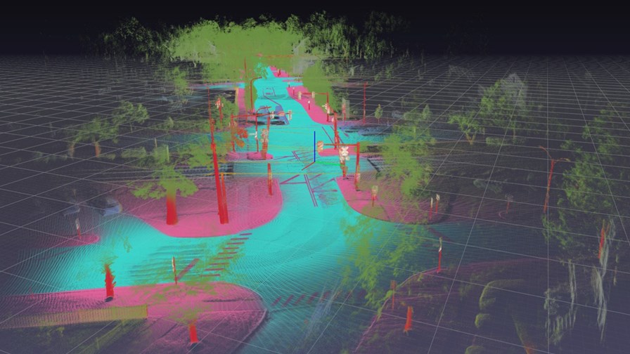
HERE Geodata Model for 5G network planning 3D representation. Source: HERE
- More cell sites mean more planning and more costs
- Some estimates imply mmWave deployments may require ten times the number of cell sites
- Tools which can help with the planning are going to become even more important
With the 5G rollout gathering pace around the world, now is a good time to look at innovative products and services which make it easier and, most important, might lower 5G build costs through careful planning of base station deployment; getting it right first time and various forms of automation.
HERE Technologies (which started life a decade ago when Nokia bought Navteq) this week unveiled HERE Geodata Models - an application which assembles a “highly precise and scalable 3D representation” of the physical objects surrounding a 5G antenna. Into the model go any buildings, trees and roadside objects (e.g. streetlights, utility poles, overpasses, billboards, etc.) making up the immediate physical environment. (see picture above).
These 3D digital representations can then provide a 5G network planner or RF engineer with the ability to remotely conduct field surveys and precisely plan where to locate 5G antennas in order to create optimal signal coverage.
HERE says the 3D data will be integrated into the network planning and design solutions of companies such as Nokia and Kinetica.
Networks will get really dense
While Europe’s mid-band spectrum allocations for 5G are enabling network operators to mostly use the existing 4G cells and towers, and even use existing antennas with a software upgrade, in the longer run it is envisaged that the 5G networks will have to become more densified as data demand continues to grow and, eventually, with the allocation of high band millimetre wave (mmWave) spectrum, to become very much denser. According to HERE, mmWave deployments may require ten times the number of cell sites to achieve blanket coverage. That’s an awful lot of network planning. Anything which can finesse the process could generate huge savings.
HERE says the significant features of Geodata Models for 5G network planning include:
3D representations of building volumes with precision of ± 1 meter or better for the building centroid location and building geometry, including building heights;
3D cylindrical representations of individual tree trunks with geospatial and geometric precision of ±1 meter or better;
3D volume representations of tree foliage/vegetation with geospatial and geometric precision of ±1 meter or better;
3D cylindrical representations of the vertical components of individual utility poles with geospatial and geometric precision of ±1 meter or better;
3D cylindrical representations of the vertical components of individual streetlights with geospatial and geometric precision of ±1 meter or better; and
Digital Terrain Models (height maps of the bare earth) with resolution levels of 1 meter or better.
HERE also produces a Cellular Signals product which can give operators a detailed snapshot of their own mobile network coverage as well as that of competitors. Signal strength is represented for each cell tower in a polygonal configuration and HERE claims this helps cellular carriers monitor the performance of their own network while also conducting competitive analysis to identify areas of relative strength and weakness against network peers.
Email Newsletters
Sign up to receive TelecomTV's top news and videos, plus exclusive subscriber-only content direct to your inbox.


